21 Ağustos 2014 Perşembe

Visit the sets of this year’s Emmy Award nominees on Google Maps


Whether you’re into D.C. intrigue or Khaleesi’s conquests, chances are you’re watching the Emmy Awards on Monday. To get ready for the show, relive your favorite moments from this year’s nominees with Google Maps. Let’s take a peek at a highlight reel of some hot spots and scenes!

If you’re craving ribs after a House of Cards binge-watching session, head over to Frank Underwood’s favorite restaurant, Freddy’s BBQ Rib Joint, in Baltimore on Street View.

Street View of the filming location of Freddy’s BBQ Joint in Netflix’s House of Cards

More in the mood for afternoon tea? Then visit Highclere Castle in North Wessex Downs, where PBS’ critically-acclaimed drama Downton Abbey is filmed.

Photo Sphere of Highclere Castle, North Wessex Downs, the filming location of PBS’ Downton Abbey

Tired of teaching high school chemistry like our friend Walter White from AMC’s Breaking Bad? Well, look no further, because we heard that Albuquerque’s Los Pollos Hermanos is hiring.

Street View of the filming location of Los Pollos Hermanos in AMC’s Breaking Bad

Warlords, the Night’s Watch and royalty from all the Seven Kingdoms can agree that the scenery in HBO’s Game of Thrones seems like it’s from another world. Google Maps lets you fly over Marrakech to visit Aït-Ben-Haddou, the set of Yunkai, one of the cities conquered by the Mother of Dragons, Daenerys Targaryen.

Photo of Aït-Ben-Haddou, Marrakech, Morocco, filming location of Yunkai in HBO’s Game of Thrones

Or if political intrigue is more your style, then you might be surprised to learn that Olivia Pope and Associates from ABC’s Scandal do their fixing at the Palace Theatre in downtown Los Angeles!

Street View of the filming location of Olivia Pope and Associates in ABC’s Scandal

While we can’t get you a ticket to the awards, Google Maps can at least make you feel like an extra on the set of your favorite show. Happy (Street) viewing!

20 Ağustos 2014 Çarşamba

Explore the geysers and waterfalls of Iceland on Google Maps


In his book Tales of Iceland, Stephen Markley wrote, “The problem with driving around Iceland is that you’re basically confronted by a new soul-enriching, breath-taking, life-affirming natural sight every five... minutes. It’s totally exhausting.” We've never been ones to take someone else's word for it when it comes to sightseeing, so we took Street View to some of the most stunning locations throughout the country. As it turns out, Markley was right...and now with Street View, you can take a journey through Iceland to explore these beautiful places too.

We started with Iceland's "Golden Circle," a famous loop in the southern part of the country. Here’s a look at the famous Gullfoss Waterfall on the Hvítá river in the south west of the country. The average amount of water crashing over the falls can reach as much as 140 cubic meters/second at its summertime peak.


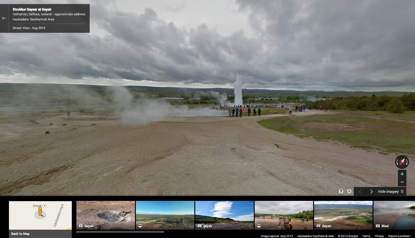
Then, we made the trek to what’s known locally as “Geysir,” or the Haukadalur Geothermal Area. Our cameras snapped footage of Strokkur, which routinely erupts every five to 10 minutes, and the bigger Geysir, which is largely dormant now but used to erupt several times a day. Interestingly, this is the geyser that lent its name to the phenomenon in many languages.


We’ve also captured beautiful heritage sites including Vatnajökulsþjóðgarður, a national park, and the UNESCO site Þingvellir, a place of great historical, cultural and geological importance. Iceland's Parliament, Alþingi, was established on this site in the year 930, and in 1930 the national park was established to protect the remains.


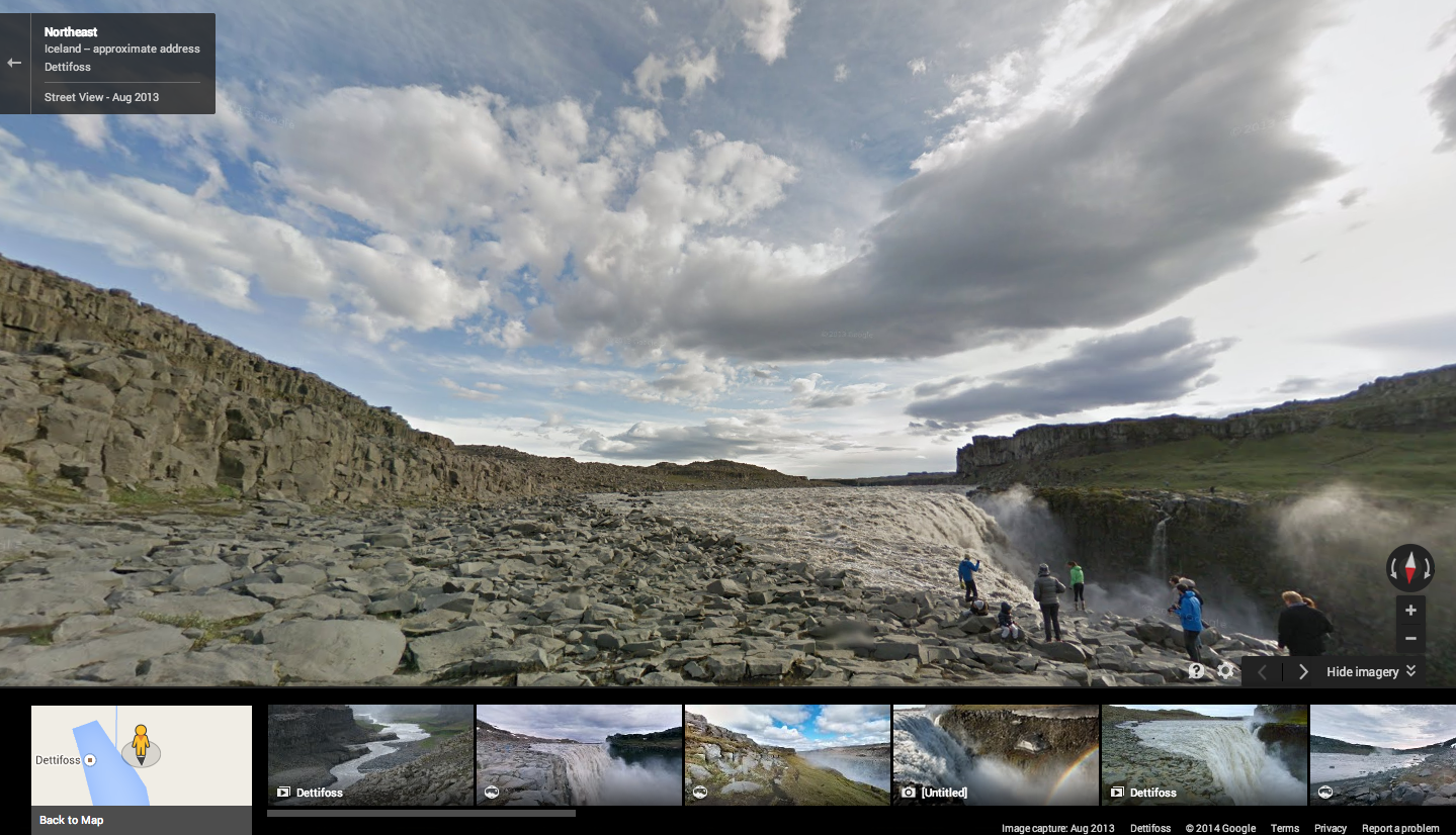
And the wonders don’t stop there. Gaze at Dettifoss, a waterfall situated in the Vatnajökull National Park and said to be the most powerful waterfall in Europe, or explore Kerið, the perfect volcanic crater lake.


So start your virtual exploration now—and it's OK if, like Markley, exhaustion sets in and you need to take a nap in the middle. We—and Iceland's astonishing natural beauty—will be waiting.

7 Ağustos 2014 Perşembe

Take a college road trip with Street View


Whether you’re a college applicant or a curious parent getting to know your kid’s new home away from home, Street View can take you on a walking tour of schools around the world. Starting today, you’ll be able to explore 36 new university campuses across the U.S. and Canada with Street View in Google Maps.

First stop: Georgetown University in Washington, D.C. Architecture buffs will love Georgetown's Healy Hall, a National Historic Landmark and iconic building in the Romanesque revival style.


Now let’s head south. If a tropical climate is more your speed, maybe the University of Miami is the right place for you. Strolling UM’s scenic pathways winding through palm trees and clear blue water, you almost need to put on your shades. Talk about extra credit!


Finally, let’s stop by the University of Regina in Canada. Founded in 1911, the school is known for its emphasis on experiential learning. Although its Saskatchewan location can get pretty cold, students can take advantage of the beautiful green when the sun is shining.


These universities are the latest additions to the hundreds of college campuses all over the world that are already available for you to explore in Google Maps. To see if a Street View tour of your dream school is available, search for a particular university on Google Maps and click on Pegman to enter the Street View imagery. Visit our Street View gallery for global highlights and other popular universities around the world.

So if you can’t make it in person, Street View can help you get a feel for the place you’re considering spending the next four years. And for you parents out there, this might help you get used to the idea of an empty nest!